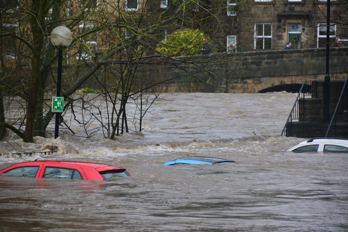

LHASA / BEIJING — Following the catastrophic monsoon landslides and flash floods that devastated border corridors between Nepal and China, emergency management authorities in the Tibet Autonomous Region have launched a comprehensive search, rescue, and evacuation operation to locate and secure 261 foreign nationals reported stranded or temporarily unaccounted for in remote mountain passes. Concurrently, state cyber regulators and public security bureaus have initiated a strict enforcement campaign targeting the dissemination of unverified death tolls and fabricated disaster footage on social media networks.
The stranded foreign nationals—primarily comprised of alpine trekking expeditions, pilgrimage groups bound for Mount Kailash, and overland international tour convoys—became cut off after landslides obliterated several mountain road segments along the China-Nepal Friendship Highway. Communication blackouts caused by damaged fiber cables and severed cellular towers initially exacerbated concerns regarding their safety.
Search and Rescue Mobilization in High-Altitude Terrains
Disaster response teams, supported by People's Liberation Army (PLA) high-altitude helicopter squads and armed police units, have reached several isolated transit stations. Emergency rations, satellite phones, warm bedding, and medical supplies have been air-dropped into cut-off valley encampments.
- Consular Verification: Foreign ministry officials in Beijing are coordinating closely with embassies from Germany, France, Japan, India, and the United States to confirm traveler manifests and verify individual safety statuses.
- Road Clearing Corridors: Over 40 heavy excavators and hydraulic rock-clearing machines have been deployed to carve temporary single-lane bypasses through mudslide debris.
- Medical Triage: Mobile high-altitude medical units have treated dozens of stranded travelers for mild hypothermia, acute mountain sickness, and minor physical injuries sustained during rockfalls.
| Operational Sector | Current Operational Status | Resource Allocation |
|---|---|---|
| High-Altitude Helicopter Reconnaissance | Active across 4 mountain valleys | 8 Specialized Transport Helicopters |
| Friendship Highway Road Restoration | 65% of blockages cleared or bypassed | 40+ Heavy Excavators & Bulldozers |
| Foreign Traveler Verification | 194 confirmed safe; 67 in transit | Dedicated Multi-Nation Consular Desk |
| Satellite Telecom Emergency Relays | Operational in all major relief zones | 12 Mobile Satellite Uplink Terminals |
Regulatory Action Against Digital Disinformation
While frontline responders labored in treacherous weather conditions, cyber administration officials noticed a surge of sensationalist claims, digitally altered disaster videos, and inflated casualty figures circulating on domestic and international social media platforms. In response, regulatory agencies issued directives ordering digital platforms to verify sources before amplifying disaster content.
Public security officials emphasized that during natural disasters, fabricated claims regarding dam collapses or mass casualties trigger severe public panic, impede genuine emergency coordination, and cause unnecessary distress to families awaiting news of their loved ones. Several individuals responsible for fabricating viral rumors were issued administrative warnings and penalties.
The Imperative of Early Warning Infrastructure
Regional authorities noted that the incident underscores the urgent need to expand cross-border meteorological data sharing between China, Nepal, and international meteorological agencies. Real-time satellite precipitation monitoring and automated river gauge relays can provide critical hours of advance warning, enabling tour operators and local communities to evacuate high-risk mountain corridors prior to slope collapse.
Frequently Asked Questions
A: Many international visitors were participating in high-altitude trekking circuits, mountaineering expeditions, or cultural pilgrimages along remote Himalayan highway routes when sudden flash floods destroyed road access.
A: Specialized high-altitude helicopters, satellite communication units, and tracked bulldozers are being utilized to reach cut-off zones and establish emergency evacuation corridors.
A: Spreading unverified death tolls or fabricated claims of dam collapses causes public panic, obstructs real-time emergency communication, and misleads international consular efforts.
Cross-Border Crisis on the Friendship Highway: Stranded Convoys and High-Altitude Rescue
Along the precipitous gorges of the Sino-Nepal Friendship Highway connecting Kathmandu to Lhasa via the Gyirong (Rasuwa) and Zhangmu border crossings, the sudden nocturnal cloudburst transformed seasonal mountain streams into raging torrents of mud and granite boulders. Over 150 fatalities were recorded along the trans-border corridor as debris flows swept away customs staging areas, border trade depots, and tourist transport convoys.
Because late August and September mark peak overland travel and pilgrimage season toward Mount Kailash, Lake Manasarovar, and Everest North Base Camp, hundreds of international trekkers and foreign nationals were caught in isolated canyon bottlenecks when bridge abutments gave way. Chinese emergency management brigades and Tibetan high-altitude rescue squads deployed heavy tracked amphibious carriers and drone-dropped communication relays to locate 261 foreign travellers whose satellite transponders went offline during the storm.
Simultaneously, cybersecurity and civil affairs authorities in Beijing and Lhasa launched enforcement sweeps against unverified social media accounts circulating fabricated casualty lists and AI-manipulated disaster videos, emphasizing that accurate manifest verification with foreign embassies required strict cross-checking at physical evacuation checkpoints.
| Disaster Response Dimension | Field Status & Technical Metric | Strategic Recovery Priority |
|---|---|---|
| Precipitation Anomaly | 300–340 mm recorded in 18-hour cloudburst window | Deploy high-resolution valley Doppler radar & automated rain gauges |
| Search & Rescue Logistics | 340+ military & civil helicopter airlift sorties flown | Restore Bailey bridges along Arniko, BP, and Syabrubesi highways |
| Hydropower & Grid Impact | ~480 MW generation offline due to intake & penstock damage | Rebuild desilting basins with armored boulder-deflection weirs |
| Glacial Lake Monitoring | 24+ high-altitude moraine lakes under SAR satellite watch | Expand trans-boundary telemetry & automated valley siren networks |
Consular Coordination and Trade Corridor Stabilization
Embassies in Kathmandu and Beijing established 24-hour crisis coordination desks to match passport manifests from licensed trekking agencies against helicopter evacuation logs. Meanwhile, logistics operators warn that damage to the Rasuwagadhi and Tatopani customs dry ports will temporarily divert bilateral overland commerce—including solar modules, electronics, and agricultural produce—toward maritime routes via Kolkata.
- UAV Thermal Reconnaissance: Long-endurance unmanned aerial vehicles equipped with infrared optics mapped stranded vehicle convoys across 60 kilometers of severed canyon roadway.
- Embassy Manifest Verification: Biometric check-in terminals at Gyirong and Syabrubesi allowed consular officers to confirm the safety of evacuated foreign nationals within hours of airlift arrival.
- Slope Stabilization Engineering: Rock-bolting, shotcrete reinforcement, and debris-flow check dams are being installed along unstable cliff faces before commercial freight trucks resume transit.
Related Prime Media Investigative Dispatches
Frequently Asked Questions (Editorial Briefing)
Q1: Why did the number of missing persons change so rapidly during the Nepal-China flood crisis?
Mountain landslides severed fiber-optic cables, cellular towers, and bridges across dozens of remote districts. As satellite terminals and helicopter rescue teams reached isolated valleys, local ward registries were merged into the central disaster database while evacuated survivors were cross-checked and removed from missing lists.
Q2: What causes flash floods in the Himalayas to be so destructive compared to plains flooding?
Steep mountain gradients accelerate runoff into high-velocity debris flows carrying boulders and mud, while warm rain at high altitudes destabilizes glacial moraine lakes and saturated highway slopes simultaneously.
Editorial Analysis & Fact-Checking by Elena Rostova (Aerospace, Deep Science & Quantum Editor), Prime Media Global Desk.