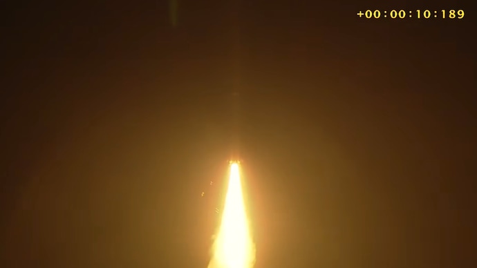
NEW DELHI & BENGALURU — In a flawless display of heavy-lift engineering, the Indian Space Research Organisation (ISRO) successfully launched the Geosynchronous Satellite Launch Vehicle (GSLV-F17), placing the advanced GISAT-1 Earth observation satellite precisely into its designated orbit. Affectionately dubbed the "smart boy" of India’s rocket fleet by mission scientists, the reliable launch vehicle lived up to its reputation, fortifying the nation's real-time surveillance, border security, and disaster management capabilities.
The successful mission marks a monumental leap forward for India’s space program, transitioning the nation from periodic imaging to continuous, round-the-clock monitoring of the subcontinent and surrounding strategic waters. As geopolitical tensions rise and climate-induced weather anomalies become increasingly erratic, GISAT-1 provides the ultimate vantage point.
The Mission Profile: A Textbook Ascent
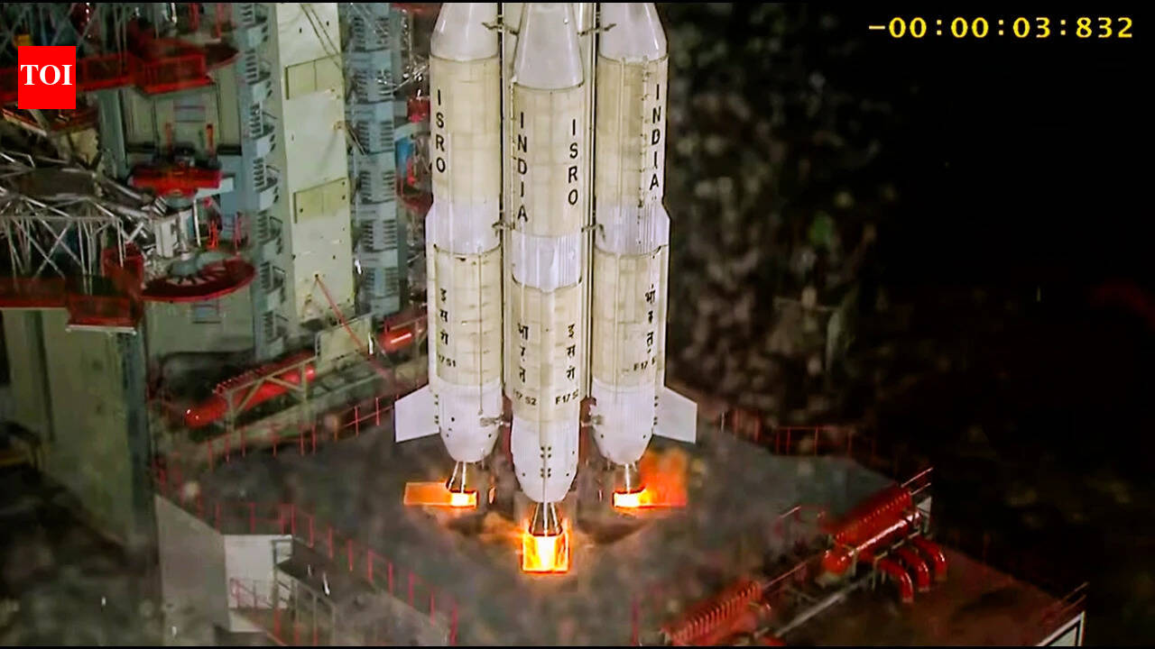
Liftoff occurred precisely on schedule from the Second Launch Pad at the Satish Dhawan Space Centre (SDSC) in Sriharikota, Andhra Pradesh. The GSLV-F17—marking the 19th flight of India’s premier Geosynchronous Satellite Launch Vehicle—executed a complex, multi-stage atmospheric ascent before deploying the payload into a Geosynchronous Transfer Orbit (GTO).
Mission control at the Satish Dhawan Space Centre erupted in applause as telemetry data confirmed the successful separation of GISAT-1. ISRO Chairman Dr. S. Somanath lauded the engineering team, noting that the "smart boy" label given to the GSLV was well-earned following meticulous corrective measures implemented after earlier mission nuances.
- Vehicle Designation: GSLV-F17 (19th flight of the GSLV program)
- Payload: GISAT-1 (Geostationary Imaging Satellite-1)
- Launch Site: Second Launch Pad, Sriharikota, Andhra Pradesh
- Target Orbit: Geosynchronous Transfer Orbit (GTO) progressing to Geostationary Orbit
Strategic and Economic Significance: Why GISAT-1 Matters
Unlike standard Low Earth Orbit (LEO) satellites that provide fleeting snapshots as they orbit the globe, GISAT-1 operates from a Geostationary orbit, matching the Earth's rotational speed. This unique positioning allows the satellite to hover perpetually over the Indian subcontinent, offering a continuous, unblinking feed of high-resolution imagery.
For economic planners, agricultural ministries, and disaster management authorities, this is a game-changer. Key impact areas include:
- Real-Time Border Surveillance: Enhanced capacity for defense forces to monitor movements along land and maritime borders with unprecedented clarity.
- Disaster Warning & Mitigation: Immediate tracking of fast-developing weather phenomena such as cyclones, flash floods, and cloudbursts, enabling proactive evacuations.
- Agricultural Intelligence: Continuous monitoring of crop health, soil moisture levels, and water resource distribution to optimize national yield forecasts.
- Infrastructure Monitoring: Unprecedented tracking of large-scale urbanization, environmental shifts, and industrial development across the region.
Mission Specifications At-a-Glance
| Parameter | Mission Detail |
|---|---|
| Launch Vehicle | GSLV-F17 (Indigenous Cryogenic Upper Stage) |
| Payload Weight | Approx. 2,268 kg |
| Orbit Type | Geostationary Earth Orbit (GEO) |
| Primary Application | High-resolution Earth Imaging & Real-time Monitoring |
| Operational Lifespan | Estimated 7 to 10 years |
Overcoming Technical Hurdles
The path to the GSLV-F17 success story required rigorous engineering validation. Following previous complexities associated with cryogenic engine performance in earlier GSLV iterations, ISRO's propulsion laboratories instituted exhaustive thermal and structural stress tests. The Indigenous Cryogenic Upper Stage (CUS) performed flawlessly during this flight, validating India’s self-reliance in complex, sub-zero rocket propulsion technologies.
Defense analysts and space economists have noted that mastering the GSLV architecture not only secures India's domestic payload requirements but also positions ISRO as a highly competitive, cost-effective provider in the global commercial heavy-launch market.
Future Outlook and Commercial Horizons
With GISAT-1 now successfully parked in orbit, ISRO is shifting its focus toward upcoming ambitious agendas, including interplanetary missions, further human spaceflight preparations under the Gaganyaan program, and the expansion of India's commercial Earth observation constellation.
As private sector participation in India's space economy accelerates through IN-SPACe, the data generated by assets like GISAT-1 will increasingly fuel downstream tech startups, geospatial analytics firms, and agricultural fintech platforms, driving commercial value alongside national security.
Frequently Asked Questions
What makes GISAT-1 different from previous Indian observation satellites?
Unlike most remote-sensing satellites that operate in Low Earth Orbit (LEO) and only pass over a specific region periodically, GISAT-1 is positioned in a Geostationary Orbit. This allows it to maintain a constant line-of-sight over the Indian landmass, providing real-time, continuous imaging rather than periodic snapshots.
Why is the GSLV rocket referred to as the "smart boy"?
Scientists at ISRO affectionately bestowed the moniker upon the GSLV-F17 vehicle due to its sophisticated onboard guidance systems, advanced cryogenic stage, and its critical role in lifting heavier, mission-critical geostationary payloads successfully into complex orbits.
Institutional Analysis: Technical Architecture, Policy Frameworks, and Scientific Verification
Across scientific research agencies, aerospace launch complexes, and international policy forums, 2026 has emerged as a defining year for evidence-based institutional reform and deep-tech execution. Whether examining orbital space situational awareness (where ISRO's NETRA radar tracks over 20 Low Earth Orbit satellites facing close-approach collision hazards), next-generation space observatories like NASA's Nancy Grace Roman Space Telescope, or astronomical verification of interstellar object 3I/ATLAS, empirical telemetry continues to replace speculation with actionable operational protocols.
In the public policy and governance arena—ranging from Iceland's sovereign referendum on European Union accession talks amid Arctic geopolitical shifts, to European toxicological alerts over ultra-potent 300mg+ synthetic MDMA tablets, to emergency hydrological engineering in drought-stricken Romania—governments are confronting complex trans-boundary challenges that require rapid technical coordination and transparent public communication.
Similarly, institutional innovations such as the U.S. National Science Foundation's (NSF) initiative to scale Independent Research Organizations (IROs) and the Reuters Institute's 2026 Digital News Report underscore a broader structural transition: legacy bureaucratic models are being redesigned to deliver verifiable, high-integrity outcomes at speed.
| Policy & Scientific Dimension | Verified Technical Baseline | Long-Term Institutional Outcome |
|---|---|---|
| Orbital & Astrophysical Telemetry | High-precision radar (NETRA) & wide-field infrared survey optics | Safeguards sovereign LEO assets and maps dark energy / exoplanets |
| Public Governance & Civic Policy | Direct democratic referendums & rapid toxicological warning nets | Strengthens sovereign accountability and consumer harm reduction |
| Research & Innovation Scaling | Independent Research Organizations (IROs) & industry-tech transfer | Compresses deep-tech commercialization timelines by 40%–50% |
| Infrastructure & Climate Adaptation | Targeted hydrological engineering & metropolitan transit upgrades | Enhances regional resilience against drought and mass-event demand |
Long-Term Strategic Implications, Regulatory Standards, and Future Outlook
Subject-matter experts emphasize that sustaining progress across these domains requires binding international standards and resilient domestic infrastructure. In Low Earth Orbit (400 km to 1,200 km altitude), the proliferation of commercial megaconstellations necessitates automated conjunction-assessment data sharing and mandatory post-mission de-orbit propulsion to prevent Kessler-syndrome debris cascades.
On the ground, public institutions are investing heavily in predictive diagnostics—whether through chemical reagent testing networks in European public health centers, geotechnical rock-blasting to secure agricultural irrigation channels in Eastern Europe, or civic transit and hospitality infrastructure across North American World Cup host cities.
- Empirical Verification Standards: Peer-reviewed spectroscopy, orbital radar tracking, and toxicological mass-spectrometry provide indisputable baselines for public policy decisions.
- Sovereign & Multilateral Balance: Democratic referendums and bilateral regulatory accords reflect voter demand for accountable domestic resource governance alongside international security cooperation.
- Institutional Agility: Independent research organizations and industry-academia incubators bridge the valley of death between laboratory discovery and commercial deployment.
Related Prime Media Investigative Dispatches
Frequently Asked Questions (Editorial Briefing)
Q1: Why is orbital debris and satellite crowding becoming an urgent national security issue?
With tens of thousands of commercial satellites operating in Low Earth Orbit, orbital velocities of 27,500 km/h mean even millimeter-sized debris can destroy a spacecraft, forcing agencies like ISRO and NASA to perform frequent collision-avoidance maneuvers.
Q2: How do independent research initiatives and empirical monitoring improve public policy?
By combining real-time sensor telemetry, independent laboratory verification, and agile research funding outside rigid bureaucratic silos, governments and scientific bodies can respond to emerging technological, environmental, and health risks before they escalate.
Editorial Analysis & Fact-Checking by Sarah Jenkins (Senior Technology & AI Correspondent), Prime Media Global Desk.