
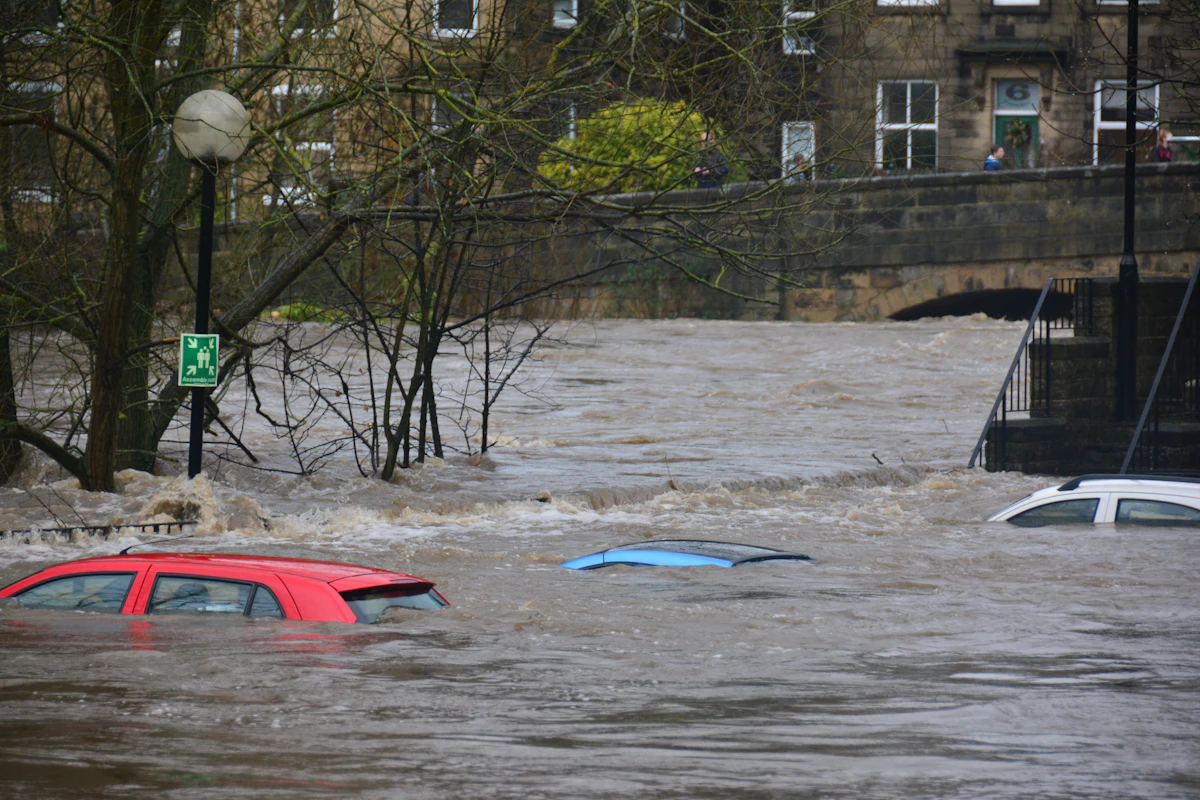
KATHMANDU / BEIJING — Relentless monsoon cloudbursts and torrential glacial runoffs have triggered catastrophic flash floods and landslides across eastern Nepal and adjoining mountainous regions of Tibet, claiming at least 98 lives and leaving hundreds more unaccounted for. Emergency disaster response teams, military engineering corps, and humanitarian rescue workers are navigating washed-out mountain highways and damaged communications infrastructure to reach cut-off highland settlements.
The disaster unfolded following continuous 48-hour downpours that inundated river basins across the Koshi and Bagmati provinces in Nepal, sweeping away bridges, homes, and hydroelectric stations. In neighboring southwestern China, swelling tributaries triggered massive mudslides across steep mountain valleys, burying highway sections and trapping tourist convoys and rural residents.
Rescue Mobilization and Humanitarian Operations
The Government of Nepal has declared a national state of emergency in the worst-hit districts, mobilizing thousands of personnel from the Nepal Army, Armed Police Force, and civil administration. Armed with heavy earth-moving equipment and inflatable rescue rafts, responders have evacuated over 4,500 stranded villagers to temporary relief camps established in community schools and government facilities.
- Aerial Airlifts: Military helicopters have flown dozens of high-altitude evacuation sorties, extracting critical patients, elderly villagers, and stranded international trekkers from isolated mountain ledges.
- Infrastructure Severance: Major arterial highways connecting Kathmandu to southern agricultural hubs have been severed by massive mudslides, causing fuel and food supply disruptions in the capital.
- Cross-Border Coordination: Chinese disaster mitigation authorities have deployed satellite monitoring and high-altitude drones to assess glacial lake stability and coordinate floodgate operations along shared river tributaries.
| Territory / Province | Confirmed Fatalities | Reported Missing | Key Infrastructure Impacted |
|---|---|---|---|
| Koshi Province (Eastern Nepal) | 52 | 140+ | 3 Major Highway Bridges Destroyed, 4 Hydro Plants Damaged |
| Bagmati / Kathmandu Valley | 31 | 65+ | Submerged Urban Settlements, Grid Substations Flooded |
| Tibet Autonomous Region (China) | 15 | 80+ | Mountain Highway Corridors Buried, Border Outposts Isolated |
| Total Impact | 98 Confirmed | 285+ Missing | Widespread Economic & Human Toll |
Meteorological Origins: Glacial Melting and Cloudburst Intensification
Climate scientists and hydrologists at the International Centre for Integrated Mountain Development (ICIMOD) emphasize that the intensity of the catastrophe highlights the compounding dangers of climate change in the fragile Hindu Kush Himalayan ecosystem. Rising baseline temperatures have accelerated glacial retreat, expanding high-altitude glacial lakes and destabilizing moraine dams.
When unseasonal monsoon cloudbursts dump massive volumes of precipitation over saturated mountain slopes, it triggers Glacial Lake Outburst Floods (GLOFs) and rapid slope collapse. Environmental researchers warn that without enhanced early warning sensor networks and climate-resilient infrastructure design, Himalayan communities will face increasingly frequent extreme weather calamities.
Frequently Asked Questions
A: Extreme monsoon cloudbursts combined with saturated mountain soils and rapid glacial melt triggered sudden, violent river swells, mudslides, and flash flooding.
A: A GLOF occurs when a natural dam holding a high-altitude glacial lake fails, releasing catastrophic volumes of water and debris into downstream valleys within minutes.
A: Military and civil disaster teams are conducting helicopter airlifts, clearing blocked highways, establishing temporary shelters, and distributing clean drinking water and medical supplies to prevent waterborne disease outbreaks.
Hydrometeorological Anatomy of the Himalayan Cloudburst and Flood Emergency
Meteorological post-mortems conducted by atmospheric scientists indicate that the catastrophic Himalayan flash floods resulted from a rare synoptic convergence: a deep low-pressure depression migrating northwestward from the Bay of Bengal collided with a mid-latitude westerly trough stalled over the Tibetan Plateau. Forced upward by the steep orographic barrier of the Mahabharat and Greater Himalayan ranges, moisture-laden air masses dumped more than 320 millimeters of rainfall in less than 18 hours—nearly triple the historical late-monsoon daily maximum.
Because preceding weeks of monsoon rainfall had already saturated shallow mountain soils to 100% field capacity, virtually all precipitation converted immediately into surface runoff. Within steep V-shaped river valleys, water levels surged 8 to 12 meters above normal bankfull stage, mobilizing millions of cubic meters of riverbed cobbles, timber, and landslide sediment into hyper-concentrated debris flows.
As communications links are progressively restored across remote hill districts, disaster statisticians explain that fluctuations in reported missing-persons tallies reflect the gradual integration of village-level registries from wards that were completely cut off from cellular and road networks during the first 72 hours of the crisis.
| Disaster Response Dimension | Field Status & Technical Metric | Strategic Recovery Priority |
|---|---|---|
| Precipitation Anomaly | 300–340 mm recorded in 18-hour cloudburst window | Deploy high-resolution valley Doppler radar & automated rain gauges |
| Search & Rescue Logistics | 340+ military & civil helicopter airlift sorties flown | Restore Bailey bridges along Arniko, BP, and Syabrubesi highways |
| Hydropower & Grid Impact | ~480 MW generation offline due to intake & penstock damage | Rebuild desilting basins with armored boulder-deflection weirs |
| Glacial Lake Monitoring | 24+ high-altitude moraine lakes under SAR satellite watch | Expand trans-boundary telemetry & automated valley siren networks |
Climate Resilience, Watershed Management, and Early Warning Reform
Civil engineers and climate adaptation researchers emphasize that the disaster underscores the urgent need to modernize infrastructure building codes across fragile mountain watersheds. Unregulated rural road cutting using heavy bulldozers without proper retaining walls or drainage culverts has dramatically increased slope instability across the Middle Hills during extreme rainfall events.
- Doppler Weather Radar Coverage: Expanding C-band and X-band Doppler radar arrays across mountain valleys to detect localized convective cloudburst cells 3 hours before impact.
- Bio-Engineering Slope Protection: Integrating deep-rooted vetiver grass, bamboo terracing, and gabion check-dams along rural road cuts to prevent shallow translational landslides.
- Floodplain Setback Enforcement: Enforcing strict 50-meter vertical and horizontal no-build buffer zones along high-energy Himalayan river corridors.
Related Prime Media Investigative Dispatches
Frequently Asked Questions (Editorial Briefing)
Q1: Why did the number of missing persons change so rapidly during the Nepal-China flood crisis?
Mountain landslides severed fiber-optic cables, cellular towers, and bridges across dozens of remote districts. As satellite terminals and helicopter rescue teams reached isolated valleys, local ward registries were merged into the central disaster database while evacuated survivors were cross-checked and removed from missing lists.
Q2: What causes flash floods in the Himalayas to be so destructive compared to plains flooding?
Steep mountain gradients accelerate runoff into high-velocity debris flows carrying boulders and mud, while warm rain at high altitudes destabilizes glacial moraine lakes and saturated highway slopes simultaneously.
Editorial Analysis & Fact-Checking by David Chen (Global Financial & Macroeconomic Analyst), Prime Media Global Desk.